
10:16 am-I’m finally getting around to the ’08 electoral maps.
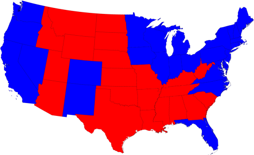
The state-by-state map-Obama took the west, northeast tier, and made inroads in the South and Midwest.
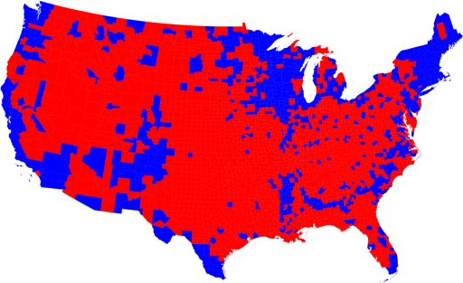
The second is a county by county breakdown, which is a bit more revealing-it shows that Democratic voting is clustered in largely urban areas, all over the country. This time there was a bit more penetration into rural counties, central and the South.
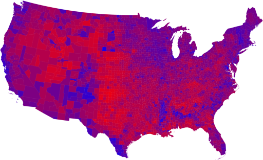
The third is the county by county, but shaded so that the actual vote tallies, red vs blue, run along a spectrum based on percent of red vs blue.
This is much, much more revealing, and shows that the scale has tipped in favor of Obama across the board. There are very few places that weren’t fairly evenly divided Reps vs Dems. This makes for a purple map, rather than a red vs blue map.
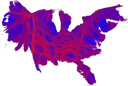
Finally there’s the cartogram. This map has each county’s size changed to reflect the population of that county. This distorts the U.S. map to look something like some odd bird or a fish. Solid GOP is in very few places-much more solid Dem this time.
1:20 pm-Going home early-I’m sick. Finished up unit testing one bit, waiting on a response. Not much else-home, dinner, to bed. Up, kids to school, to work.
Listening to: DN!, Zappa